Met Office issues yellow ice warning in West Yorkshire as temperatures plummet
and live on Freeview channel 276
The warning has been set due to ice and will be in place until Saturday, December 10 at noon.
Some disruption is likely due to icy surfaces, and people may need to be careful to prevent some injuries from slips and falls on icy surfaces.
Advertisement
Hide AdAdvertisement
Hide AdUntreated roads, pavements and cycle paths may have icy patches.
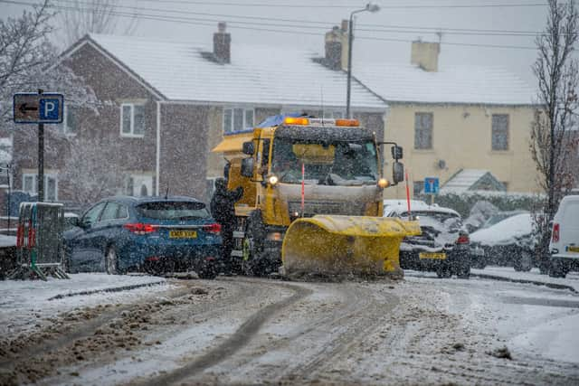

There are predictions of severe overnight frost, freezing daytime temperatures and wintry showers across the region..
The warning comes after the Met Office issued a level three cold weather warning across England - including the entire Yorkshire and Humber region, which is expected to be in place until Monday, December 12.
Wakefield:
Friday:
Advertisement
Hide AdAdvertisement
Hide AdA cold start, with a widespread sharp frost and risk of icy surfaces.
Otherwise, largely dry with sunny spells, just the chance of the odd coastal wintry shower.
Remaining cold despite the sunshine. Winds generally light. Maximum temperature 3 °C.
A widespread sharp frost soon forming under largely clear skies, with a few freezing fog patches possible.
Advertisement
Hide AdAdvertisement
Hide AdPerhaps turning cloudier for some west Pennine hills with a few snow showers. Minimum temperature -6 °C.
Saturday:
Cold. Any freezing fog patches slow to lift, otherwise mostly dry with sunny spells.
A few wintry showers for the western Pennines. Light winds.
Maximum temperature 2 °C.
Sunday:
Very cold, especially overnight with widespread frosts and some freezing fog patches.
Often sunny, away from any lingering freezing fog patches. Wintry showers at times, predominantly along coasts.
Dewsbury:
Friday:
Advertisement
Hide AdAdvertisement
Hide AdA cold start, with a widespread sharp frost and risk of icy surfaces.
Otherwise, largely dry with sunny spells, just the chance of the odd coastal wintry shower.
Remaining cold despite the sunshine. Winds generally light. Maximum temperature 3 °C.
Saturday:
A widespread sharp frost soon forming under largely clear skies, with a few freezing fog patches possible.
Advertisement
Hide AdAdvertisement
Hide AdPerhaps turning cloudier for some west Pennine hills with a few snow showers. Minimum temperature -6 °C.
Sunday:
Very cold, especially overnight with widespread frosts and some freezing fog patches.
Often sunny, away from any lingering freezing fog patches. Wintry showers at times, predominantly along coasts.
Halifax:
Friday:
A cold start, with a widespread sharp frost and risk of icy surfaces.
Advertisement
Hide AdAdvertisement
Hide AdOtherwise, largely dry with sunny spells, just the chance of the odd coastal wintry shower.
Remaining cold despite the sunshine. Winds generally light. Maximum temperature 3 °C.
A widespread sharp frost soon forming under largely clear skies, with a few freezing fog patches possible.
Perhaps turning cloudier for some west Pennine hills with a few snow showers. Minimum temperature -6 °C.
Saturday:
Advertisement
Hide AdAdvertisement
Hide AdCold. Any freezing fog patches slow to lift, otherwise mostly dry with sunny spells.
A few wintry showers for the western Pennines. Light winds. Maximum temperature 2 °C.
Sunday:
Very cold, especially overnight with widespread frosts and some freezing fog patches.
Often sunny, away from any lingering freezing fog patches. Wintry showers at times, predominantly along coasts.